8/23/2006

volcanoes from space

REF: WWW.REDORBIT.COM

Santorini, Greece
This ASTER image of Santorini was acquired on November 21, 2000 and covers an area of 18 by 18 km.
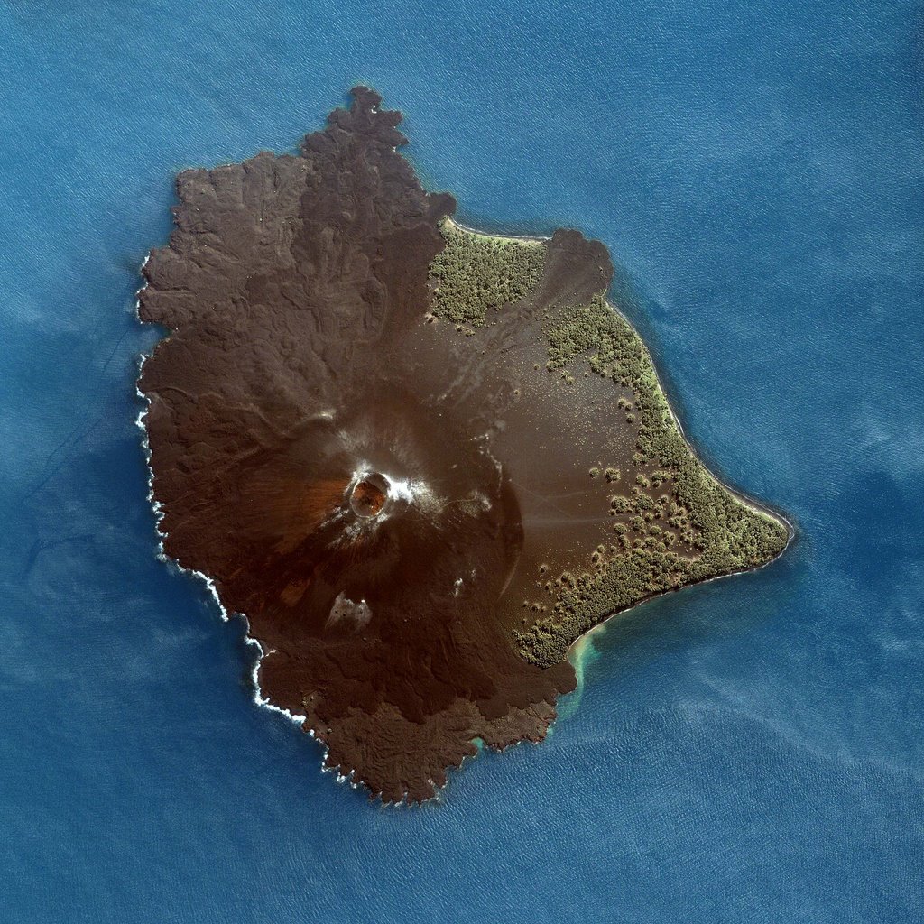


Krakatau, Indonesia
This detailed image of the young volcano was taken by the Ikonos satellite on June 11, 2005. The volcano’s circular crater sits southwest of the center of the island and is surrounded by fresh lava flows and ash. The black shores of the island are scalloped where the flows have solidified in the ocean.
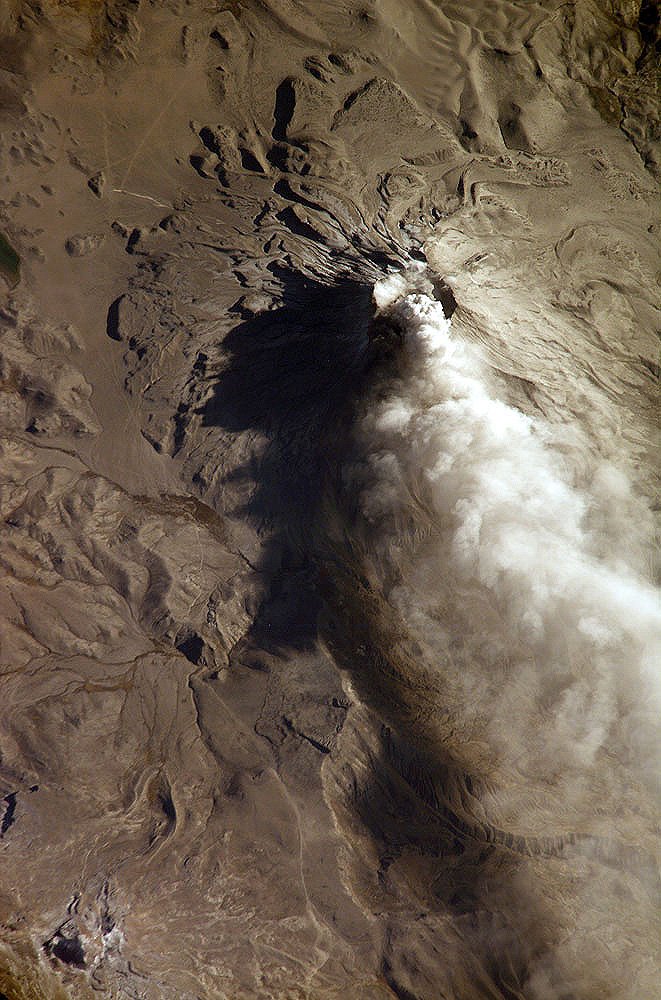
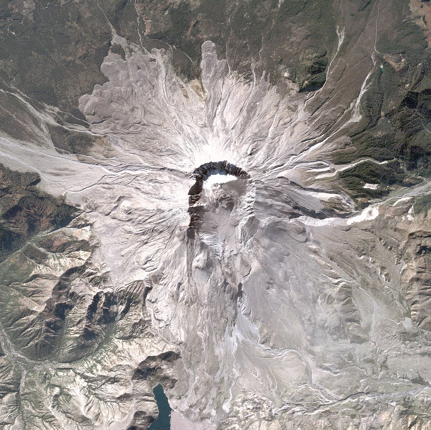


Unibas, Peru
This oblique image (looking at an angle) from the International Space Station (ISS) captures an ash cloud first observed on satellite imagery at 11:00 GMT on August 14, 2006. An ISS astronaut took this picture one hour and 45 minutes later.


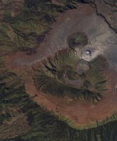
Gunung Bromo, Indonesia
This image shows most of the Sandsea Caldera, along with Gunung Bromo and the older volcanoes on the caldera floor. A small plume of steam is visible rising out of Mt. Bromo. Space Imaging’s IKONOS satellite, capable of 4-meter per-pixel color imagery, and 1-meter per-pixel
resolution panchromatic imagery, acquired the data on July 8, 2001.
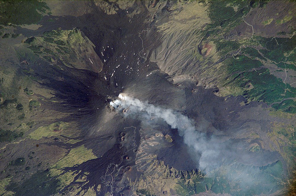


Mt. Etna , Italy

Astronaut photograph ISS013-E-62714 was acquired August 2, 2006, with a Kodak 760C digital camera using an 800 mm lens, and is provided by the ISS Crew Earth Observations experiment and the Image Science & Analysis Group, Johnson Space Center


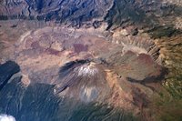
Pico de Teide and Pico Viejo , Tenerife:
Astronaut photograph ISS013-E-23272 was acquired June 8, 2006, with a Kodak 760C digital camera using an 800 mm lens, and is provided by the ISS Crew Earth Observations experiment and the Image Science & Analysis Group, Johnson Space Center.


Vesuvius, Italy
Quickbird satellite on July 12, 2002


Mt. St.Helens , USA


8/02/2006

tsumani in Java 17-07-2006


On July 17th, 2006 a tsunami hit southwest-Java and killed more than 550 people. The tsunami was the result of a sea quake in the Indian ocean with a force of 7.0 on the scale of Richter. The coast of the tourist village Pangandaran was struck hardest by the waves.
This are the images I revieved from a friend in Java, showing the flooding.

POINT LOBOS (California, USA)

'Carmelo Formation. Conglomarate with granodiorite pebbles of vulcanic origin


Carmelo Formation (Paleocene: 60,000,000 years old)

Around 60 million years ago, the Salinian block subsided and ocean waters filled the granodiorite canyons. On land, ancient rivers carried lava from distant volcanoes down to the shoreline, and along the way scoured it into rounded pebbles and cobblestone-sized rocks. Over time, these rocks and layers of sand were deposited on the submarine canyon walls by underwater landslides and eventually cemented into a conglomerate called the Carmelo Formation. For many people, the Carmelo Formation is the most interesting type of rock at Point Lobos. It is softer than the granodiorite and is easily seen along the south shore of the reserve, where it has been eroded by ocean waves to form a photogenic series of coves, crevices and shelves.

The Carmelo formation is composed of thousands of layers of conglomerate, sand stone, and mudstone which the turbidity currents have deposited. The mudstone was deposited as marine mud. Most pebbles in the conglomerate are of volcanic origin. Conglomerate and sandstone are shades of brown, with concentrations of reddish brown iron oxide common in the sandstone. Mudstone is gray.


sandstone formations

source: http://pt-lobos.parks.state.ca.us/ (Jeff Thomson)
fotos: Gertjan Laurenssen